
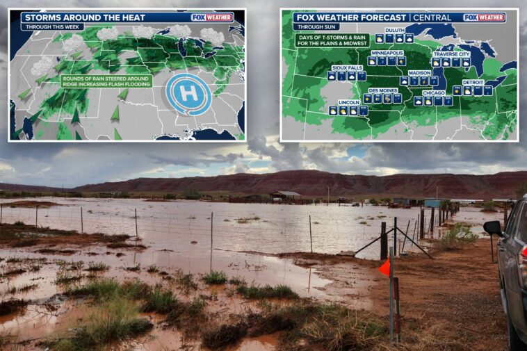

A multi-day flash flood threat covering millions of people across the Midwest and Central Plains has been extended through Sunday as a stalled weather pattern is expected to bring relentless rounds of thunderstorms over the region.
NOAA’s Weather Prediction Center (WPC) has issued a Level 2 out of 4 flash flood threat for parts of the Midwest through Sunday, where a widespread 3–5 inches of rain is expected all told, with some localized areas potentially seeing 5–8 inches.
The initial rounds of storms began at the beginning of the week, bringing flooding to parts of Western Iowa.
The heavy rain sent rivers and creeks out of their banks in Cass County.
With soils already saturated from the start of the weeklong deluge, this will only compound the flood threat.
A September scorcher across the South is fueling what’s shaping up to be a September soaker for parts of the Plains, Midwest and Great Lakes.


An intense heat dome has reformed over the Southeast, with many states experiencing their hottest start to September on record.
Rounds of storms filled with deep tropical moisture are moving from the Southwest and the Gulf around the western flank of the heat dome, creating the weeklong rainy pattern, with storms capable of producing intense rain rates.
Start your day with all you need to know
Morning Report delivers the latest news, videos, photos and more.
Thanks for signing up!
On Thursday, heavy rain is expected to focus across South Dakota, which the WPC identifies as the larger area of concern for flash flooding.
Forecast rainfall totals of 2–4 inches, locally higher, are possible, with the heaviest threat centered across western and central South Dakota before spreading eastward toward the I-90 corridor and Sioux Falls area.


A level 2 out of 4 flash flood threat extends from southeastern Wyoming across South Dakota into southwestern Minnesota and northwestern Iowa.
According to the FOX Forecast Center, severe storms could ignite over Nebraska, Kansas and Iowa again on Friday, with heavy rain forecast for southern Minnesota and much of Wisconsin, including Minneapolis and Milwaukee.
The core of the flood threat is expected to begin to shift eastward into the Great Lakes by Saturday.