
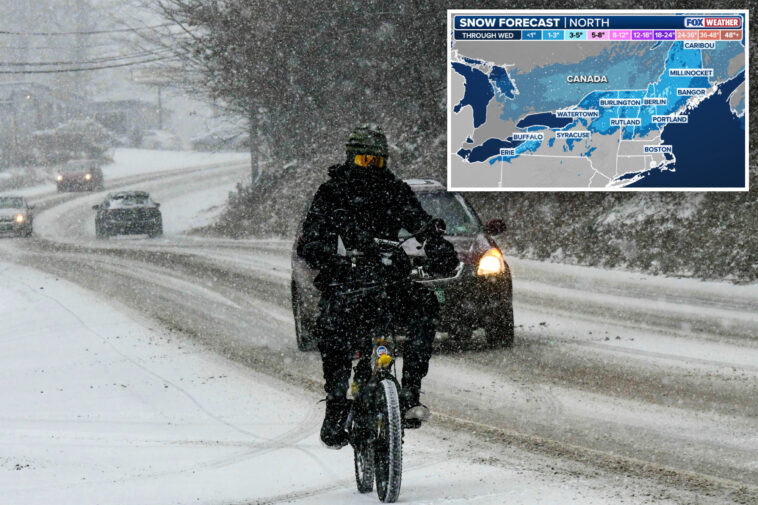
A fast-moving clipper system began Monday and is expected to track through New England, bringing yet another round of snow to parts of the northern US that have already had their fill so far this winter.
Light snow fell across parts of the Northeast on Monday, with a few inches reported across portions of New England and a few light snow showers in areas such as New York City.
This comes as the Northeast has already experienced a plethora of winter weather.
Most notably, areas just outside New York City, such as Mamaroneck, New York, received a light dusting of snow.
Buffalo, New York, received just under five inches of snowfall on Sunday as the Bills officially wrapped up their final regular-season game ever at Highmark Stadium.
Tuesday, an additional storm system will push into the Upper Midwest.
This raises concerns about icing due to freezing rain, which would go hand in hand with unsafe road conditions for drivers, as well as the risk of black ice.
Icing is any deposit or coating of ice on an object caused by the impingement and freezing of a liquid, according to the National Weather Service (NWS).


The NWS has issued a Winter Weather Advisory for parts of Minnesota, including the Twin Cities, until noon on Tuesday.
Earlier on in the day, forecasters will shift their attention to the Upper Midwest, where temperatures will rise just enough to produce a wintry mix as another system develops.
Start your day with all you need to know
Morning Report delivers the latest news, videos, photos and more.
Thanks for signing up!
With this growing threat, areas to monitor for a swath of icing include Minnesota, Wisconsin and Michigan.
Ice amounts appear light, according to the FOX Forecast Center, but it is still a concern in cities such as Detroit, Minneapolis, and Green Bay, Wisconsin.


To wrap things up on Wednesday, another system is expected to reach New England, bringing another mixed-precipitation setup: snow for higher elevations, a possible ice threat closer to the coast and spotty rain farther south.
There are a few areas to monitor by midweek, but a mixture of snow showers and ice remains the main threat for the northern tier of the US this week.