ATLANTA – A significant winter storm is marching across the South on Friday after producing snowy and icy weather in the Dallas Metroplex and the southern Plains on Thursday.
Winter weather is moving through the Southeast and into the mid-Atlantic and Northeast through the day.
Freezing rain will lead to dangerous icy conditions, with up to a third-inch of ice expected across north Georgia, including Atlanta, and the Upstate of South Carolina.
Winter weather alerts stretch from Arkansas to Delaware and north into the Midwest and Great Lakes, covering 80 million people across nearly 20 states.
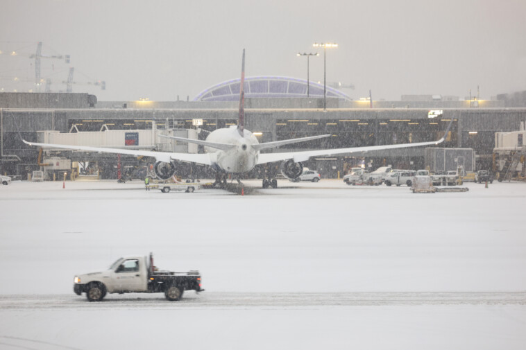
The storm has snarled air travel across the country.
Thousands of flights have been canceled, including more than 400 out of Atlanta’s Hartsfield-Jackson airport – the nation’s busiest airport – where a ground delay has been issued.
That means flights could be held on the ground longer than normal so the airport can better manage traffic during the inclement weather.
Major disruptions to flights at Charlotte-Douglas International Airport in North Carolina were also reported, with at least 330 flights canceled.
Georgia Gov. Brian Kemp declared a state of emergency ahead of the snow. Four other states have also declared states of emergency: Alabama, Arkansas, Tennessee and North Carolina.
Wintry road conditions caused numerous traffic accidents and spinouts across several states.
Georgia Department of Transportation Commissioner Russell McMurry said there were a “significant amount” of spinouts on the roads Friday morning.
Winter weather caused crashes on Interstates 75 and 285 in the Atlanta metro area. State plows were ordered to create driveable lanes that were to be retreated to prevent icing on roads, according to McMurry.
The commissioner said 600 snow plows have been activated across the state.
Despite these precautions, numerous state roads near Atlanta and parts north were closed due to patches of ice, according to the DOT’s website.
The Arkansas Department of Transportation reported that the vast majority of roads were covered in snow or slush Friday.
Weather-related traffic accidents have been reported statewide, including on interstates 40, 30 and 555.
FOX Weather Meteorologist Jane Minar reported that heavy wet snow was falling in Little Rock, Arkansas, on Friday morning. About 7 inches had already fallen in the city.
Clinton National Airport in Little Rock reopened late Friday morning after crews were able to clear enough snow from the airfield.
Road conditions began to deteriorate Thursday evening. Dashcam video shows a semi-truck jackknifing on snow-covered Interstate 430 in Little Rock.
Exclusive FOX Weather Storm Tracker Brandon Copic captured video Thursday evening of a line of disabled vehicles piled up due to winter conditions on Interstate 30 south of Malvern, Arkansas.
FOX Weather Meteorologist Michael Estime also reported heavy wet snow in Memphis, Tennessee.
State officials encouraged people to stay home to allow plow trucks to operate freely.
Focusing on Helene disaster zone
Areas in western North Carolina and eastern Tennessee that were devastated by Hurricane Helene will see several inches of snow as the region continues to recover from the disaster.
Places such as Asheville, North Carolina, could receive as much as 3 inches of snow.
Higher amounts are likely in the higher elevations near the North Carolina/Tennessee border.
Drone video from FOX Weather Exclusive Storm Tracker Mark Sudduth shows debris in the Swannanoa River that still remains from Hurricane Helene coated in snow and ice as the storm moved over Asheville.
Parts of the Swannanoa were actually frozen.
Emergency management teams were staged in Western North Carolina and the central part of the state said North Carolina Emergency Management Director Will Ray at a Friday news conference.
Snow and ice were also spotted in Asheville’s historic Biltmore Village which was hit particularly hard by Helene.
Bitter cold will accompany the storm with temperatures ranging from near freezing during the day Friday to the teens by Saturday night. Gusty winds will add an extra bite to the cold and make it dangerous to be outside.
Snow and ice continue across South through Friday
Additional snow and ice will continue to blanket the South through Friday.
“Significant ice accumulation on power lines and tree limbs may cause widespread and long-lasting power outages,” National Weather Service forecasters wrote in the Winter Storm Warning issued for Atlanta.
Charlotte and Columbia, South Carolina also could see significant icing, according to the FOX Forecast Center.
The highest snow accumulations Friday will be across Tennessee and Kentucky where 5-8 inches of snow may fall.
The storm will quickly move along the South and Gulf Coast before moving off the East Coast beginning Friday evening.
Mid-Atlantic, Northeast will also see snow
Snowy weather is expected along parts of the heavily populated Interstate 95 corridor before the storm exits the U.S. on Saturday.
A couple of inches of snow is possible in places such as Washington and Philadelphia, while New York City and Boston could see a dusting.


