
Winter is here and so are nor’easters.
A nor’easter is a powerful low-pressure system that forms along the East Coast of North America.
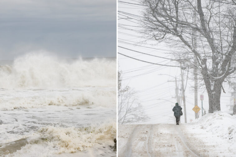
Named after the direction in which the strongest winds blow, this powerful coastal storm mainly impacts states along the Eastern Seaboard in New England, the Northeast and the mid-Atlantic.
According to the National Weather Service (NWS), Boston, New York City, Philadelphia and Washington, DC, are especially vulnerable due to proximity to the coast.
Nor’easters are most frequent from September through April when the jet stream is at its strongest but can occur any time of the year.
They cause high wind gusts, snow, rain, rough surf and occasional coastal flooding.
How does a nor’easter form?
These powerful storms begin to form 100 miles off the coast between Georgia and New Jersey, which is the perfect spot.
There must be a dip in the jet stream that blows cold air southward out of Canada and sends it eastward toward the warm Atlantic Ocean.
Once the warm water and the cold Arctic air meet, a low-pressure system forms, fueling a nor’easter.


The contrast between the warm water and the cold air provides enough instability and energy that is needed for these storms to develop.
Nor’easters then move northeastward toward New England and Canada in order to reach their maximum intensity.
How are storms considered nor’easters?
Wind direction plays a huge factor in defining a nor’easter. During a nor’easter, winds blow from the northeast off the Atlantic Ocean.
If winds are coming from the east or southeast during the storm, then that system is not considered a nor’easter.
This type of storm is also associated with a strong low-pressure system off the East Coast.

As long as the storm has all the right ingredients, a nor’easter can start at any point of the year.
If the systems end up bringing northeasterly winds to the East Coast during the fall and temperatures are in the 50s, then the precipitation would fall as rain. But if the system formed in the winter when temperatures were in the 20s, the precipitation would turn into snow.
What are the different types of nor’easters?
Nor’easters have two types of storms.
First is Miller Type-A. This type of nor’easter is more common during a La Niña pattern and forms in the Gulf of Mexico or southwest Atlantic, and then travels along the coast.
This type of storm happens when a strong polar jet dips southward and meets a low-pressure system.
Start your day with all you need to know
Morning Report delivers the latest news, videos, photos and more.
Thanks for signing up!
The NWS says this is considered the classic nor’easter.
The system’s origin point is often a frontal boundary that is draped across the Gulf Coast and Florida.
As the low moves up the Eastern Seaboard, the system usually rapidly intensifies with significant snowfall likely in the mid-Atlantic and into areas of the interior Northeast.
Due to the system’s trajectory, large chunks of the I-95 corridor tend to miss out on the heavy snow, with rainfall that cuts down on accumulation rates.

The other type of nor’easter is Miller Type-B. This is when the nor’easter starts in the Midwest and moves eastward before falling apart around the Appalachians.
The center later redevelops along the East Coast and produces a more significant storm system than compared to the first area of low pressure.
This type of storm usually occurs in autumn or winter and can produce intense blizzard conditions, hurricane-force winds and significant coastal erosion.
Due to the development zone, severe weather across the Southeast is often not a threat, but the risk for significant travel disruptions across the Northeast is usually greater because of less warm air entrained in the nor’easter, which means a greater chance of ice and snow.
A Miller Type-B is rather tricky to forecast due to the center essentially jumping around.