
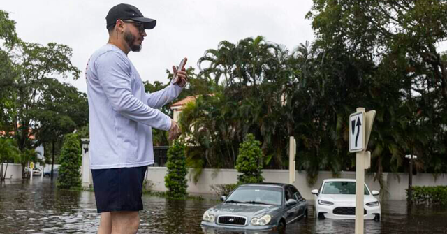
The Sunshine State has been anything but sunny the past several days heading into the weekend, experiencing unusually wet weather for this time of year, supercharged by the super El Niño.
Rounds of storms have been battering the peninsula this week, causing the St. Johns River to surpass record levels, coming to 17.7 feet with expectations of it rising higher in Brevard County.
Both Broward County and the City of Hollywood declared states of emergency as the floodwaters rose.
“So we’ve been driving through the city of Hollywood,” Hollywood Mayor Josh Levy said in a social media update while driving through the floods. “Really bad areas are west of the Turnpike. Here we’re actually west of I-95. So there are a variety of neighborhoods, could be all the way east to all the way west, but certainly west of I-95 and the Turnpike that really have a lot of standing water.”
“We’re all aware of it, and together in coordination with the county and the state authorities and city public utilities. We’re all making an effort to help these people here and try to drain this water as quickly as we can. Sometimes there isn’t a natural body of water to drain the water to, so things might be slower,” he said. “But let’s hope the rain subsides and we’re able to get this water receded and pumped out as quickly as possible.”
According to 7 News Miami, “The intense rainfall led to Davie and Hollywood reporting more than 12 inches of rain. Sunrise reported over eight and a half inches of rain, and Dania Beach reported almost seven and a half inches of rain.”
In a Thursday morning update, NWS Miami said a flood watch remains in effect for all of southeast Florida through the evening.
“While rainfall totals are not expected to be as high today, it will not take much to exacerbate areas that are already saturated,” it warned. “Widespread additional 1-2″ today with localized 3-5″ possible.”
The northern part of the state is getting battered as well.
A flood watch remains in effect for the northern regions of Florida, according to NWS Jacksonville, which noted the area has seen between two and five inches of rain. However, more rain is on the way, with an additional two to six inches possible through Saturday.
Famed meteorologist Jim Cantore has shared a variety of videos showing the severity of the flooding, as waters surround vehicles and homes.
“Since last night the rainfall has shifted to Florida’s mid-Coast,” he continued, sharing satellite imagery of the rains.
“Heavy rain has set up over Rockledge, Cape Canaveral and Port St. John this morning. We continue to see the St. Johns River go above RECORD at Cocoa and we are still expecting a lot of rain in this area through Saturday morning,” he said, noting that a low is developing off the coast of the state as well.