
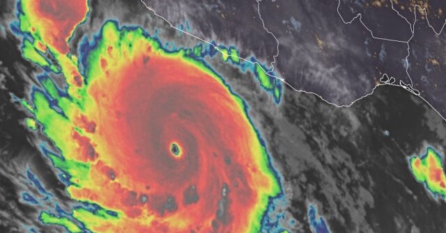
Hurricane Polo, which is churning in the Pacific, grew to a Category 5 storm early Tuesday less than 24 hours after it was deemed a hurricane.
The National Hurricane Center (NHC) is monitoring several areas across the Pacific as an El Niño has produced 18 storms in the Pacific Basin, Fox Weather reported:
Hurricane Polo is a Category 5 storm currently about 220 miles southwest of cities along Mexico’s southwest coast, and is moving east at 6 mph, with sustained winds of 160 mph, according to the NHC.
While it will not make landfall anywhere near the U.S., moisture from Polo is already streaming into the Southwest and is expected to enhance monsoon thunderstorms over New Mexico, beginning Tuesday.
Officials said Hurricane Polo was forecast to take a sharp turn northwest and west-northwest, barely missing Mexico as it hovered nearby for a few days, according to NBC News.
“A tropical storm watch was issued for part of the coast south of Manzanillo in Colima state to Tecpan de Galeana in Guerrero state, meaning tropical storm conditions were possible in the area within two days. Polo was centered about 360 miles (579 kilometers) south-southeast of Manzanillo,” the outlet stated.
Forecasters said there would be heavy rain with possible flooding and landslides in the Guerrero and Michoacán states over the next few days.
Radar showed the hurricane swirling over the ocean near the Mexican coast:
A storm is deemed a hurricane when its maximum sustained winds reach 74 miles per hour and the higher the category, the more there was a risk for it to cause damage if it made landfall, according to the National Oceanic and Atmospheric Administration (NOAA).
“Hurricanes originate in the Atlantic basin, which includes the Atlantic Ocean, Caribbean Sea, and Gulf of America, the eastern North Pacific Ocean, and, less frequently, the central North Pacific Ocean,” the administration’s website read.